On this episode of MandoAdventures I will be traveling Mormon Well Road and enjoying the spectacular desert views, Yucca Forest, and ancient rock formations.
Map can be found below
https://www.birdandhike.com/Hike/DNWR/Roads_DNWR/Road_Mormon/maps/MormonRd_Map-o.htm
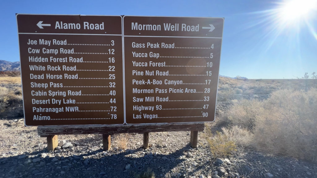
Mormon Well Road
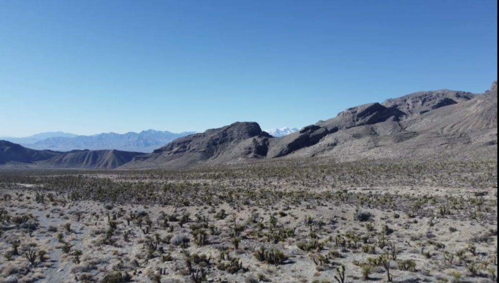
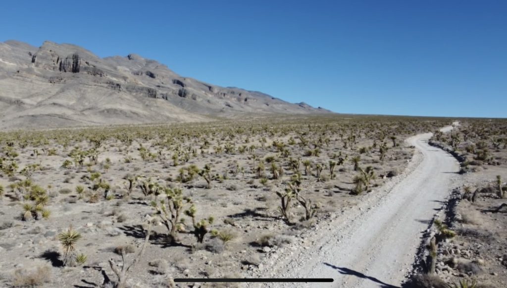
This off road trail is a long, rough, dirt road that runs across the Desert National Wildlife Refuge from Corn Creek to Highway 93. The road runs across the desert and over the mountains through spectacular country, including towering limestone cliffs; broad, flat valleys; and narrow, winding canyons. The road runs through several desert vegetation life zones, starting in the very dry (stunted) Mojave Desert Shrub Zone and climbing to the Yellow Pine (Ponderosa Pine) Zone. The variety of life zones provides different habitats for birds and other wildlife.
The Road is long and rough. A 2WD High Clearance vehicle is required if the road is dry, and a 4wd vehicle might be needed if the road is wet or washed out. There are no services. If you go out there, take at least 1 gallon of water per person, some food, and expect to be the only people out there. Be prepared to break down and spend a night waiting for help to find you. Your cell phone probably won’t work.
Although the road is rough, much can be driven at 15 mph in 2wd-HC vehicles, but there are rocky spots and tight turns that seem to sneak up, even at low speeds. In particular, starting into Yucca Forest and out near Sawmill Canyon always seem to be rough. The Sawmill Canyon Road is 4WD only due to deep gravel.
This trail is great place to get away from it all, but remember that this is wild and remote country — you could be the only person out there for a long time.
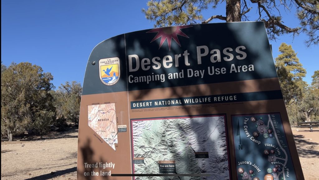
Desert Pass Campground
Just beyond the saddle (mile 25.5), ponderosa pines shade campsites at Desert Pass Campground (formerly Mormon Pass Campground). The camp area has several campsites with picnic tables, fire pits, and vault toilets. The campground is a bit spread out. Just before arriving at the obvious campground, a spur road to the west leads to two campsites on the hillside. At the first obvious camp area, there are several sites and the first outhouse. The remaining campsites are located farther north along the main road (all on the west side).
Where the road hits Sawmill Canyon Wash, it turns right and runs east. This part of the road is pretty good, but a bit bumpy. The road runs down through Elbow Canyon and around the Elbow Range, and eventually runs down the bajada to Highway 93 (mile 41.7), arriving at the highway where powerlines cross the road (about 2 miles south of Highway 168 (Site 0649)).